Ungava Bay Multibeam Bathymetry Survey
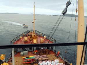
The Canadian Hydrographic Service (CHS) contracted Seaforth Geosurveys Inc. in for the provision of multibeam bathymetry surveys of a selection of corridors throughout Ungava Bay, QC. Survey data […]
The Canadian Hydrographic Service (CHS) contracted Seaforth Geosurveys Inc. in for the provision of multibeam bathymetry surveys of a selection of corridors throughout Ungava Bay, QC. Survey data […]
From August to December of 2018, Seaforth Geosurveys Inc. was contracted by Canadian Hydrographic Service (CHS) to conduct multibeam bathymetric surveys of pre-selected sites throughout Northumberland […]
In August of 2018, Seaforth personnel joined Legends of the Deep film series hosts, Celine and Fabien Cousteau, to provide Seaforth’s expertise in seabed mapping […]
During the summer of 2014, Seaforth Geosurveys Inc. was contracted by TGS Canada Ltd. (TGS) to conduct a seabed mapping program to identify and characterize […]
In November of 2019, Seaforth Geosurveys Inc. was contracted by the Ocean Tracking Network (OTN), a global aquatic animal tracking, data management, and partnership platform based […]
Between 2009 and 2015, Seaforth Geosurveys Inc. was contracted by GEMTEC Ltd. for the provision of multibeam echosounder, subbottom profiler, sediment and water sample collection […]
Seaforth assisted Sea-Force Diving and the Canadian Coast Guard’s Environmental Response Team in efforts to assess and contain a fuel leak from the M/V Manolis […]
Earlier this month, Seaforth completed a high-resolution multibeam and sub-bottom profile survey of the St. Anns Bank & Laurentian Channel for the Department of Fisheries […]
Government report on how Nova Scotia is leading the Ocean Technology sector The Nova Scotian provincial government’s jobsHere program has put together a great report […]
Seaforth Engineering Group was contracted by the Department of Public Works and Government Services Canada, on behalf of the Department of National Defense (DND), to […]