Optimum Site Selection for Tidal Energy Development
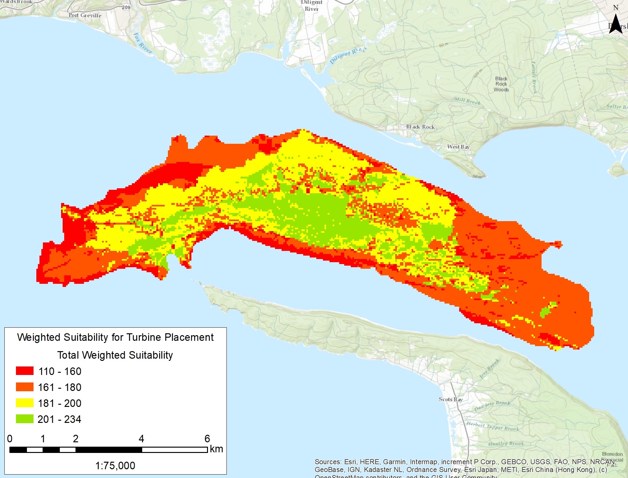
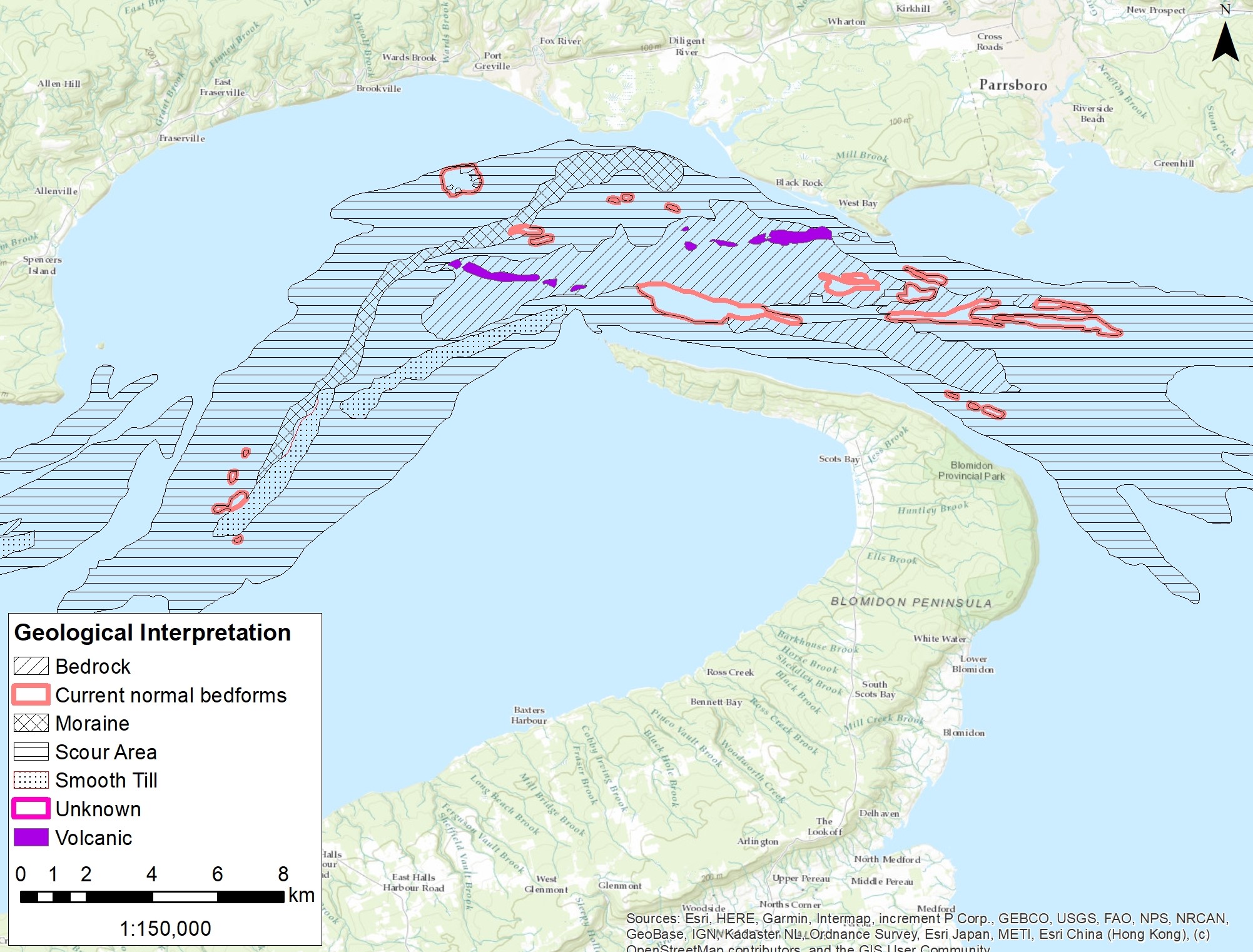
In the spring of 2016, the Offshore Energy Research Association (OERA), under commission of the Nova Scotia Department of Energy, had engaged Cape Sharp Tidal Development Ltd. to lead a team of collaborators for the Instream Tidal Energy Resource Characterization of the Bay of Fundy Study Area project. Included in this team was Seaforth Geosurveys with their Geographic Information Systems (GIS) expertise, providing both technical and mapping support in developing a digital map series and associated data sets. Seaforth’s GIS technician organized the project datasets into a common GIS framework and utilized GIS geoprocessing and analysis tools to produce final suitability mapping layers for use in the investigation of optimum site selection for future tidal energy development in the Bay of Fundy region.